
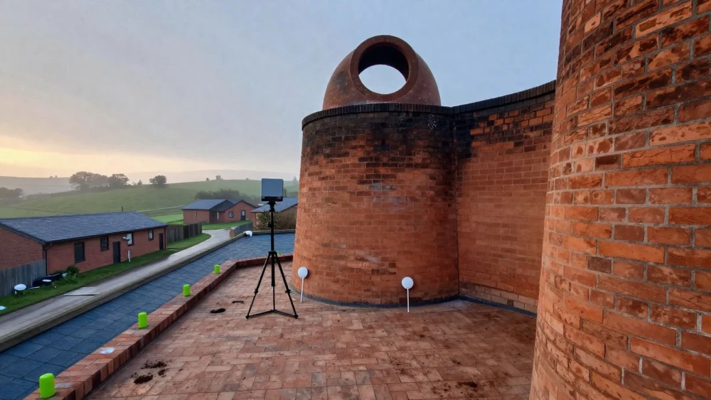
3D Laser Scanning
Get in TouchAt Stoke Surveys, we specialise in 3D laser scanning for detailed and accurate measurements. This advanced surveying technique allows us to capture high-precision data for various projects, including architectural design, construction, and heritage preservation.
Our scanners support a wide range of applications, delivering reliable and precise results. For projects , our 3D laser scanning services provide invaluable insights.
Contact us today to discuss your requirements.
How Much Does 3D Laser Scanning Cost?
3D laser scanning typically costs between £500 and £1,500 per day, depending on the project's complexity and the area being scanned. Factors influencing the cost include site accessibility, data resolution needs, and post-processing requirements.
Our services often involve using equipment like the Leica RTC360, known for its speed and precision, which helps in capturing highly detailed point cloud data. We adhere to industry standards such as PAS 1192 for Building Information Modelling (BIM) projects, ensuring the delivery of accurate digital replicas.
Additionally, projects may involve different surfaces, such as terrain models or heritage buildings, influencing the required scanning time. At Stoke Surveys, we offer competitive prices and provide detailed quotations tailored to your specific project needs.
Contact us for a consultation and estimate.
What Are the Benefits of 3D Laser Scanning?
3D laser scanning offers numerous advantages, making it an ideal choice for sectors ranging from construction and architecture to engineering and real estate. The technology uses LiDAR (Light Detection and Ranging) systems to provide highly accurate point clouds that detail every aspect of the surveyed environment.
Precision: Capture data with millimetre accuracy, enabling precise measurements and detailed 3D models.
Speed: Rapid data collection saves time on site, allowing teams to focus on analysis and decision-making rather than on manual survey efforts.
Versatility: Suitable for a variety of industries and projects, from heritage conservation using HBIM (Historic Building Information Modelling) to infrastructure inspections.
Safety: Non-invasive and safe, even in hazardous environments, minimising the risk to survey personnel and the need for cumbersome safety gear.
Using our services can significantly enhance project outcomes, reducing errors and rework, and ensuring compliance with standards such as ISO 19650 for BIM processes.
How Does 3D Laser Scanning Work?
3D laser scanning works through a methodical process that ensures precision in capturing site details:
Planning: We begin by assessing the site using preliminary sketches and existing plans, determining the optimal equipment and locations for the scanners to ensure full coverage.
Scanning: Using our Faro Focus S-series laser scanners, we capture millions of data points, known as a 'point cloud', with accuracy down to a few millimetres. Our scanners rotate 360 degrees to ensure no detail is missed.
Data Processing: The raw point cloud data is processed using specialised software like Autodesk ReCap and Leica Cyclone. These tools convert the data into precise 3D models and 2D drawings as needed.
Analysis: Our experts analyse the data to provide insights into structural integrity, detect potential clashes, and suggest enhancements for the design phase.
Our team at Stoke Surveys employs the latest technology and practices to deliver precise and reliable results, ensuring that every project is on a solid foundation from the start. If you have any scanning needs, get in touch with us today.
How Long Does 3D Laser Scanning Take?
The 3D laser scanning process duration varies by project size and complexity. Typically, on-site scanning can be completed within one to two days, depending on factors such as the area scanned and access conditions.
We use advanced scanners like the Faro Focus and Leica BLK series, known for their precision and speed, enabling us to capture detailed data efficiently. Data processing then follows, taking an additional three to five days.
This stage involves converting raw point cloud data into usable formats, often using software like Autodesk ReCap or Bentley ContextCapture. We adhere to industry standards such as PAS 1192 for Building Information Modelling (BIM) to ensure data accuracy.
Our efficient workflow ensures we meet project deadlines without compromising on quality. For specific project timelines, please contact us directly.
How Long Does 3D Laser Scanning Last?
3D laser scanning results remain valuable as long as the environment surveyed remains unchanged. Our scans create a durable digital record of a site using advanced LiDAR technology, capturing detailed spatial data by measuring distances with laser light and mapping with millimetre precision.
This precise data serves as an accurate reference for construction, urban planning, renovations, historical documentation, and structural analysis, effectively serving architects, engineers, and surveyors.
The longevity of the data's usefulness largely depends on the nature of the site. For static environments, such as historical buildings, the scans may remain relevant for many years.
In contrast, dynamic sites like active construction zones might require regular updates, using Trimble or Leica scanning systems, to account for ongoing changes or to comply with RICS standards. This ensures that the digital model stays current and reliable for any future project needs.
Why Choose Stoke Surveys for 3D Laser Scanning?
Choosing Stoke Surveys for your 3D laser scanning needs ensures you benefit from our commitment to precision and customer satisfaction. Our team is highly skilled, employing Faro and Leica laser scanners capable of recording millions of data points per second.
This allows us to create accurate point clouds and detailed 3D models. We follow industry guidelines such as PAS 128 for utility mapping, ensuring our methods meet recognised standards.
Our scanning services are beneficial for various sectors, including architecture, engineering, construction, and heritage conservation. We can capture detailed measurements of complex structures, monitor construction progress or restoration projects, and support facilities management.
We aim to deliver results typically within a two to three-day timeframe, which helps in maintaining project timelines efficiently. Get in touch with us for a customised survey solution.
Speak to a 3D Laser Scanning Expert
Frequently Asked Questions
Can I See the 3D Models After Scanning?
Yes, at Stoke Surveys, we provide access to the 3D models generated from the scans. These models are supplied in various formats to suit your project needs.
Is 3D Laser Scanning Suitable for Historical Buildings?
3D laser scanning is ideal for historical buildings. It captures intricate details without damaging the structure, making it perfect for heritage conservation projects.
What Is the Maximum Range of Your Scanners?
Our laser scanners effectively capture data up to a range of 150 metres, accommodating both small and large-scale projects.
Get a Free Quote for 3D Laser Scanning
For precise and efficient 3D laser scanning services , contact Stoke Surveys today.